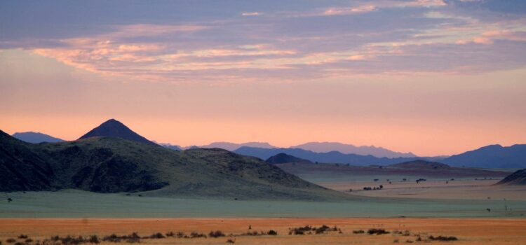
Magadikgadi Pans
These magnificent, vast salt pans are located in northern central Botswana and cover a total area of over 12,000km2. They are ancient remnants of a vast super lake which used to cover over 60,000km2 and was up to 50m deep in some places. This lake once stretched from the Makgadikgadi system north-westwards and incorporated the Delta as well as the Savuti region of Chobe. Tectonic shifts eventually reduced the flow of water into the area from the northern rivers and caused the lake to dry up. Today evidence of the lake can be seen in the form of smooth, wave shaped boulders and fossil beaches.
The pan system is made up of several separate pans, the major ones being Ntwetwe, Nxai and Sowa Pans. The Makgadikgadi and Nxai Pan National Park was formed in 1993 by combining the Nxai National Park and the Makgadikgadi Pans Game Reserve. It now covers an area of 7,500km2 within this system. The Park is unfenced, therefore allowing unhindered migration routes for the many species which are found here.
Makgadikgadi literally means “vast, open, lifeless land” and although it is far from lifeless, the area is certainly vast and open and is believed to be the largest salt pan of its kind in the world. The landscape is characterised by an endless horizon of flat, salt pan stretching into the distance, surrounded on the extreme fringes by low scrub. When the rains arrive in November or December, the pans are transformed by a vast, shallow layer of water which attracts thousands of water birds, herds of grazing herbivores and many carnivores.
Undoubtedly the most spectacular of the bird species are the greater and lesser flamingos which congregate on the pans to breed each rainy season. The pans are the second largest breeding site in Africa, and most of the birds migrate from Etosha National Park in Namibia or even from as far as East Africa.
Nxai Pan differs from Makgadikgadi in that the wide, open plains are covered in lush, sweet grassland interspersed with “islands” of trees. The grasses provide sustenance for a wide range of herbivores including huge herds of zebra as well as wildebeest, red hartebeest, impala, springbok, eland and giraffe. Associated predators such as lion, leopard, hyena and cheetah follow the migration and add their presence to a spectacular wildlife experience. The bird life in this area is equally breath-taking with around 250 species present. Among these species is the 30kg Kori Bustard, the worlds’ heaviest flying bird.
Sowa Pan is located to the east of Makgadikgadi, Sowa being the bushman word for salt. This Pan is also an important site for breeding flamingos, as well as attracting many other species during the winter months such as bee-eaters, kites and eagles. The Nata Sanctuary is a private reserve that was established to protect the bird life of this area and covers 230km2. Kubu (hippo in the Setswana language) Island is located on the western side of Sowa Pan and is a granite outcrop rising 20m above the clay and sand surface. Evidence of wave action from the bygone era of the super lake can be seen on the north-eastern side, and the fossil beaches, stunted baobab trees and mysterious stone walls combine to create an enigmatic atmosphere.
Another famous landmark in the Makgadikgadi area are the seven “Baines baobabs”, named after Thomas Baines who first immortalised them in his painting of 1862. They are positioned on a small rise and create a fascinating interruption to the endless horizon. They have changed very little since Baines’ painting and appear strangely timeless. Many of the majestic Baobab trees in the area have the signatures of explorers from past ages carved into their trunks, and act as unwitting archives of Botswana’s pioneer history.
